Story and Photos By Alan Zoellner
Club Member Since 2021
Many repeated experiences are not the same; the same meal in the same restaurant a week apart, watching the same movie twice, and, in my recent experience, this year’s trip to Franklin to camp and hike on the local trails.
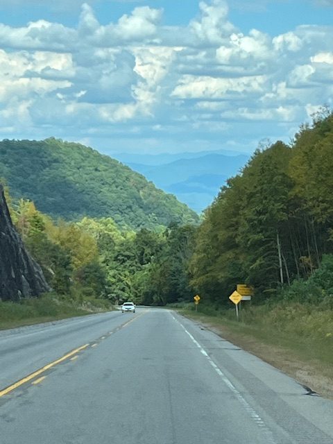
My friend and I live in east central Florida and have traveled to the Franklin region for five consecutive years to camp and walk day hikes on the Appalachian Trail. We usually go in early to mid-October and look for a dry and cool forecast window, excellent for camping and hiking. That plan has always provided perfect conditions and yes, has spoiled us. However, because of numerous obligations this year, we moved up our arrival date to late Monday, September 16.
On Monday, we arrived in the Franklin area. Until the day before, the weatherman had forecasted dry conditions but a low-pressure system that had formed off of the Carolina coast days earlier eventually moved west instead of the north or northwest direction. As such, we started our first two days with occasional rain and cloudy conditions, not what we were expecting. But all was not lost.
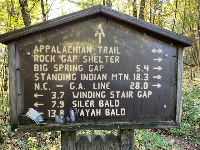
On Tuesday, our first full day in the Franklin area, we made the best of the conditions and hiked two hours from Rock Gap to near Glassmine Gap before the approaching rain turned us around back toward our vehicle. On that hike, we met one section hiker who was hiking his 23rd section and 84 miles that week to Fontana Dam. Like us, he was happy to be on the trail, even with less-than-perfect weather.
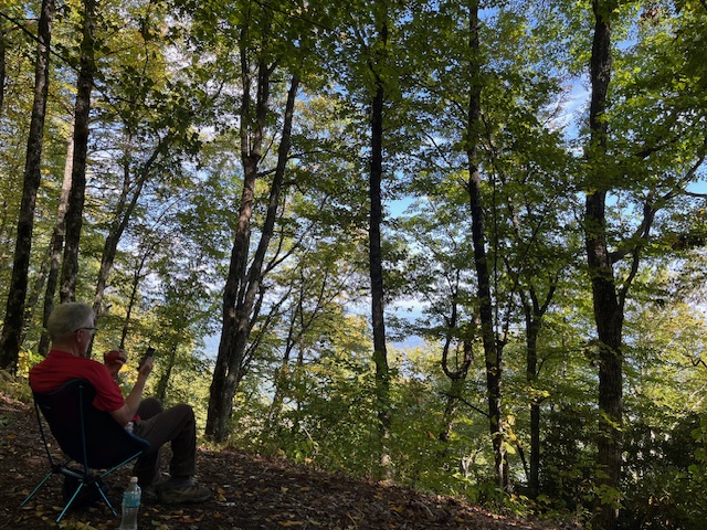
On Wednesday, we drove up to Betty Creek Gap, walked the spur trail to the AT, then south to the overlook southwest of Pickens Nose. We encountered some light rain that morning, and the thick cloud cover eliminated any views toward the east, normally a great viewing site of the Clayton, GA., valley and distant mountains. We returned to Betty Creek Gap but continued to Mooney Gap, where we enjoyed a leisurely lunch before returning to our vehicle by way of the Forest Service Road. That day’s hike was three-and-a-half hours long, and around 1 p.m. we started seeing some patches of blue skies and knew that weather conditions would improve in the following days.
On Thursday, after finding some light dew on our tarps and some early morning haze, the sun appeared around 8:30 a.m. We decided to hike Beech Gap Trail to Beech Gap, one of my favorite day hikes in the area.
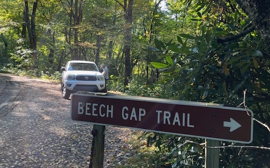
The trail quickly crosses a long bridge over the river, then climbs for about 10 minutes before leveling out for a more pleasant 90-minute hike to Beech Gap. The area has many large trees, a couple of side trails, which I have never explored (they show on the Organic Map app), and an old Forest Service road about halfway up to Beech Gap. At Beech Gap, we had lunch using our backpacking chairs under blue skies and temperatures around 70 degrees. This was the weather conditions we were expecting!
On Friday, we decided to tackle the challenging Lower Trail Ridge Way trail to Standing Indian Mountain, a 2300-foot climb from the Backcountry Information Center located just outside Standing Indian Campground to the summit.
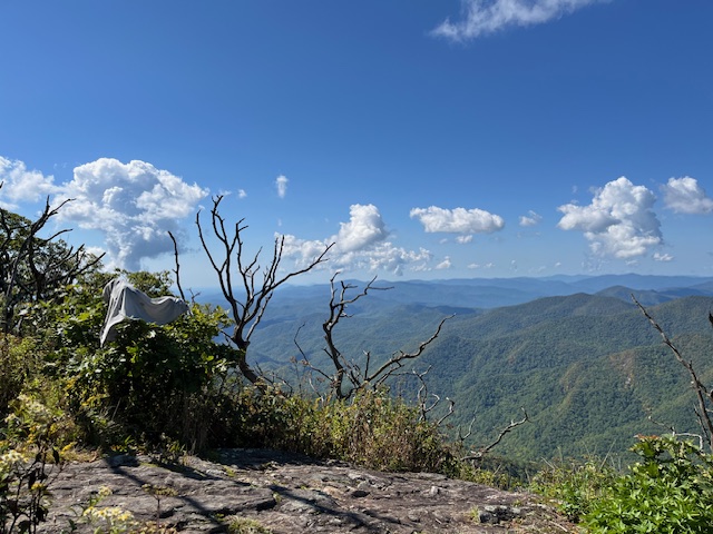
This was a solid three-hour hike to the top, where we were greeted by more blue skies, an occasional cloud, and dry conditions, perfect conditions for lunch and enjoying the great view west and south into Georgia. We met two hikers at the top who had hiked the same trail then another hiker with his dog on our return trip back down the same trail. That day’s hike was a six-and-a-half hour hike, including lunch. Thankfully, the previous three hikes had slowly acclimated us to the rigor of this hike. We each ate steak for dinner that evening to celebrate our success on the trail.
On Saturday, our last day in the area, we hiked down from Rock Gap to the remains of the Wasilik Popular, once one of the largest popular trees east of the Mississippi River. When I first saw it six years ago, the buttress was still standing, but about three years ago it fell, which is how we viewed it. Even on the ground in several pieces, it was still an impressive sight and gives one an idea of how large many of these trees originally stood in the Southern Appalachian Mountains before they were cut a hundred years ago. Some online research tells the story that there were two large popular trees in the same area. A team of large oxen were employed to remove part of one tree back up to Rock Gap, but once the oxen had reached there, they refused to go back down for the second tree!
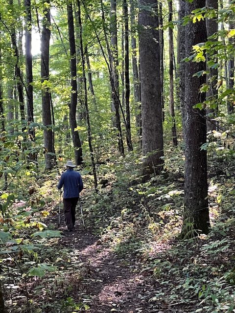
Finally, on early Sunday morning, we departed and returned to our respective homes in Florida twelve hours later. So how was our trip?
First, we didn’t expect the rain the first two days. The low pressure off the Carolina coast that was originally forecasted to drift north or northwest ended up moving west toward the Franklin area and provided some light rain and cloudy conditions, which obscured our views. We were prepared with our ponchos on the trail and tarps in the campground, so it was a little inconvenient. The rain did reduce the number of hikers on the trail, and since I enjoyed chatting with them, be they day, section or overnighter hikers, we missed that interaction. On the other hand, the woods were completely ours the first three days, during which we encountered only one hiker, a section hiker on his way to Fontana Dam. Very quiet and peaceful.
Second, we camped for six nights. Temperatures were in the low to mid-50s with highs in the lower to mid-60s. For me, my 45-degree down sleeping bag worked just fine, and many of my cold-weather clothes stayed in my bag. Arriving on a Monday is always preferred, as the campgrounds are usually only partially filled during the week. By Friday, it was about 80% filled, but most campers are respectful of their neighbors and quiet down after 10 p.m.
Finally, it’s a full day’s drive from Florida leaving at 5 a.m. and arriving at and setting up our campsite at 5 p.m. after our grocery stop. In a perfect world, we would count on perfect weather like we have enjoyed the last five years, but sometimes Mother Nature sends you a curve ball, like the unexpected tropical storm that increased the rain chance on the day we were driving up. However, we enjoyed our trip, our campfires at night, my friend’s cooking skills on the two-burner stove (steaks, Italian sausage and pasta, pork chops and corn on three different nights!), talking with our campsite neighbors, and simply enjoying the wonderful Southern Appalachian Mountains.
Now that we are back in Florida, I remind myself that only through the dedication and hard work of the Nantahala Hiking Club, whose members do SO MUCH WORK to maintain the almost 60 miles of AT and the major spur trails, that this and previous trips would be VERY DIFFERENT if the club didn’t exist. I first learned about the club about five years ago when coming down Beech Gap Trail late one October day and encountered two NHC volunteers who were performing trail maintenance. After we talked for about ten minutes, I decided to join the club that evening because their efforts supported my annual trip to the area. Since I live in Florida, my ability to support the club other than the annual dues is minimal. I did volunteer one day two years ago doing trail maintenance when I was in the area. I’m very appreciative of the work and outreach the NHC performs to preserve and enhance the AT and support hikers who use this valuable resource.
If you are NOT a Nantahala Hiking Club member, I encourage you to join. If you ARE a member, I encourage you to CONTINUE to support the club with the annual membership dues. An extra amount, I’m sure, will be put to good use. Only then can we follow our club founder’s charge to “Keep ever clear the open trails which lead to mountain tops.”
Now that I am back in Florida, I am already pondering my next visit!
